
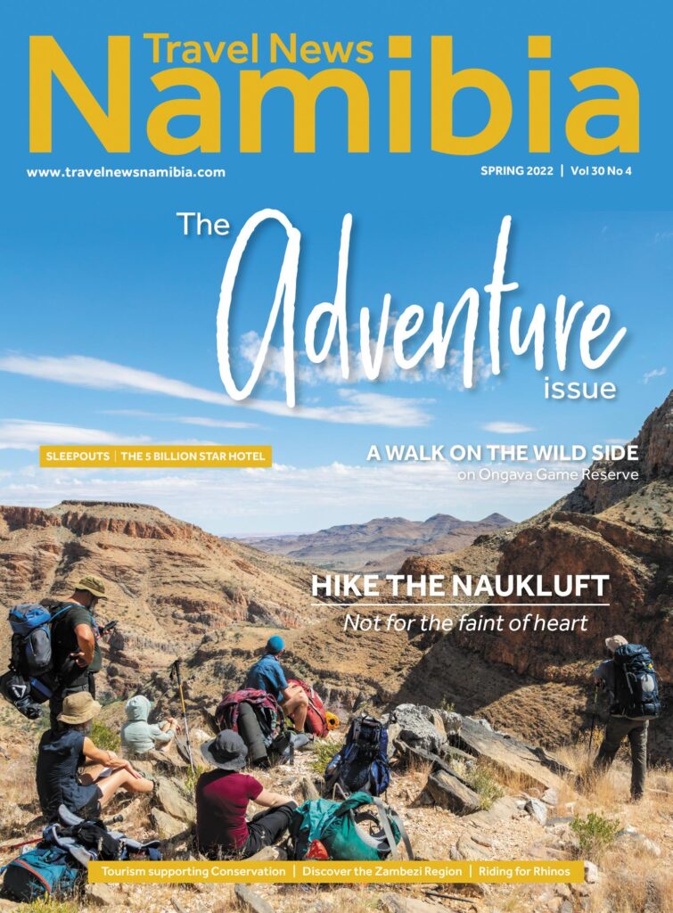
HIKING THE
Naukluft
120 kilometres in eight days
I’m not a hiker. Yet, here I find myself lifting my ridiculously heavy backpack onto my back for the first time on the morning before the start of an eight-day-long hike. The weight of the backpack immediately triggers the question: why am I doing this?
Text Le Roux van Schalkwyk | Photographs Le Roux van Schalkwyk
From the Spring 2022 issue
I have been fascinated by the Naukluft Mountains since my first visit to the park many years ago. This seemingly inhospitable mountain complex on the doorstep of the great Namib Sand Sea is surprisingly full of plants, birds and wildlife, thanks to numerous natural springs. Yet, very little of the Naukluft can be seen by the casual visitor. The only access road for tourists leads directly to the NWR Naukluft Camp. This is by no means an attempt to restrict vehicle traffic, as anyone who has flown over or driven on any of the roads (C19, C14 and D854) that form a circular route around the mountains can attest to. The extremely rugged terrain makes it a really unfriendly place for vehicles.
The only way to explore the park is on foot. There are two short one-day hikes, the Olive and Waterkloof trails. Then there is the eight-day trail that covers 120 kilometres on a circular route – with the option to do only the first four days of the hike. Once I heard of the epic eight-day hike, it immediately went onto my bucket list. I must admit, at no point did I think about the actual hiking part, but was simply very much drawn by the excitement of exploring a remarkable area that very few people ever get to see.
Fast forward to April this year and I find myself on the eve of a bucket list adventure, completely unaware of what awaits over the next few days, and mentally unprepared for it. Luckily my friends Quinton, Lynne, Roland, Sarah, Jess and Toast are all avid hikers, so I was in good hands.
DAY 1 - PEOPLE DO THIS FOR FUN?
Bright-eyed and bushy-tailed, we’re all up at the crack of dawn. I sense a bit of nervous energy as no one knows what exactly to expect over the next eight days. Backpacks are fiddled with and some last items are added or removed. Even the experienced hikers, i.e. everyone but myself, exude a sense of tenseness mixed with excitement. Pretty oblivious to what is happening with the rest, I stuff some last snacks into my bag and try it on fully loaded for the first time. I let out a loud phew as the full force of the weight almost upends me. “It will get lighter as the food and snacks get less,” I assure myself.
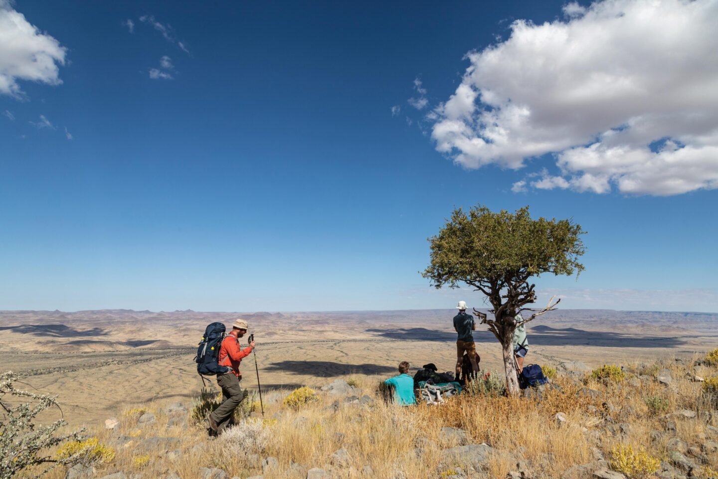
Our campsite packed up, cars parked in the shade, we fasten our backpacks and start to follow the trail markers down into the Naukluft River. Moving south towards the border of the park, the first section is fairly easy going. The first ascent is where the reality of the next eight days hits me partially. Having walked for only a couple of hours, my unfit legs already feel the climb going up a rather steep gradient which leads to a well- worn mountain zebra path that runs along the contour of the southernmost part of the Naukluft Mountains. It occurs to me that this may be a bit tougher than I thought. Apart from some slippery bits, the first day is quite stunning. The vistas below are striking and on the highest elevations of the trail, viewpoints offer spectacular vistas of the Tsaris Mountains to the south.
Our first lunch stop was at the first of the natural springs on the trail in the shade of a large ficus tree. Roland had a lie-down on a large lower branch. An idyllic scene until we got ready to leave and noticed the two-something-metre black mamba quietly moving among the higher branches. So perfectly camouflaged that when it didn’t move it was almost impossible to tell apart from the tree’s limbs.
After lunch, life was a struggle. The zebra path seemed neverending. After every bend there was another, stretching into the distance. As the afternoon wore on it became more and more mentally challenging. The group split up into separate pairs, each going at their own pace and conversation drying up as the heat of the late April day took its toll. Trapped in your own mind, you know there is no turning back or giving up – the only way is forward. And so you put one foot in front of the other. I remember thinking: “People do this for fun?”
Finally, just before sunset, a valley opened up in front of us and the Putte Shelter came into view. What a relief after a long day’s walk. The first shelter is named Putte because of the well nearby. The well is equipped with a large round hand-pump for obtaining water.
DAY 2 - DOWN WE GO
The first section of day 2 is an undemanding walk across an undulating plateau. A pleasant start after the tough day before. After a couple of hours we reach the impressive Ubusis Kloof. Massive rock faces on both sides and polished rock plates give evidence of the masses of water that once flooded down the river. A spectacular sight to behold, except that if this river does flood and you are caught in it, there is no escape.
The massive overhang of the cave at Cathedral Spring signals the start of the descent. Several chains have been anchored at points that would otherwise be extremely difficult to negotiate with a large backpack. Certain sections are quite high and caught us a bit off-guard as we weren’t expecting the climb down to be this intense. But steady as she goes – we all made it safely to the bottom of the valley.
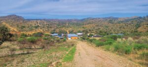
The Ubisis hut used to be a holiday cottage before the land was acquired for the park and is now the overnight stop. According to the map given to us at reception, it “is a complete surprise to the unsuspecting hiker.” Unfortunately, it wasn’t a good surprise. Because the road has been washed away, the Ministry of Environment, Forestry and Tourism is unable to reach the area by vehicle. The hut wasn’t in good shape inside and there was no water. Before setting out we were notified that the solar pump wasn’t working, but luckily, because of the good rain earlier in the year, we found a spring not far from the hut.
On the recommendation of my friends I had bought pre- packaged dehydrated meals, even though I was sceptical about the taste of these powdery-looking provisions with exotic names like Mediterranean chicken with olives and creamy parmesan chicken. The first night’s meal was average, but I was so tired it was mostly just a simple refuelling exercise. However, when I hydrated a chilli con carne for night two, I was quite surprised that this meal tasted much worse than the night before. Not knowing better and thinking that this brown watery mess at the bottom of my fire bucket was supposed to taste stale, I finished half of it before asking the others if these meals should taste like slightly spiced mouldy ceiling boards. Turns out it was stale and I just thought it was supposed to taste that way. It is supposed to have the texture of a soggy ceiling board but shouldn’t taste as such. You live and learn, I guess.
DAY 3 - BACK UP WE GO
Feeling strong after surviving the first two days and getting into the rhythm of things, the hike from here on became more and more enjoyable.
The day starts with a slog back up the Ubusis River and then up the same chains to get to the top of the kloof. The ascent is easier as you can see where you are climbing. The rest of the day is quite uneventful apart from spotting some mountain zebras as the trail follows an easy route across the plateau to the Adlerhorst Shelter.
DAY 4 - THE FEAST
Starting on fairly level terrain, the first section of the day was reasonably easy going. As the trail turned down the Tsams River, the sand and loose rocks slowed the pace. After a couple of kilometres, the trail veers off to the right as a massive tufa waterfall blocks the way down. To bypass this section you have to climb a very steep hill. After suffering the leg burns of the climb we were met with a stunning view across the valley below. The dunes of the Namib are just visible on the horizon.
The trail winds steeply down back to the river, and the descent takes a while because it is slippery. Down below, ficus trees and numerous springs make it a pleasant walk.
We are excited to get to the Tsams Ost Shelter where fresh supplies and more importantly, cold beer, are waiting for us. As there is road access to the shelter, you can arrange a resupply run on Day 4 with NWR for a small fee. After a quick exchange of our garbage and dirty clothes for food, fresh clothes, steaks and beer we waved goodbye to the NWR employees, the last people we’d see for the next four days.
With a couple of cold ones and delicious steaks, we feasted like kings – a welcome break to re-energise the spirits.
DAY 5 - NO REGRETS
Day 5 starts with a climb, a big one called Broekskeur. Immediately sweating out the small “taste of the good life” we had the night before. Was the night before worth the struggle today? Yes! It definitely was. No regrets.
The next part of the trail traverses undulating terrain, with some of the ascents a strain on our tired legs after the early morning climb. This section gives me a front seat on the rollercoaster of emotions. Coming down each slope I feel strong and ready to walk long distances. I can look around and appreciate the beautiful quiver trees and euphorbias dotting the hillsides. Going up my mind swings the other way and I wonder why I am doing this to myself. Eyes fixed on the ground in an effort to make it over the hill.
The day turned out to be quite eventful as Toast’s sole parted ways with the rest of his hiking boot. With some crafty tying of his laces, he was somehow able to keep the sole stuck to the bottom of his boot. Stopping every now and then to readjust the laces. Not the best fix, but it did the trick and, remarkably, Toast was able to finish the hike with the broken footwear.
As a result of the boot incident we briefly lost Lynne. She took the wrong trail but luckily kept her cool and retraced her steps – all is well that ends well.
After a long day, we arrived at Die Valle Shelter. Much to our frustration the 10 000 litre water storage tank was empty. Of this we had not been warned before the hike. Fortunately, a spring was close by.
DAY 6 - SLOW GRIND UP RIVER
A brief hike takes us to the incredible 200-metre-high Die Valle Waterfall. Covered in a thin film of water, this waterfall must be quite a sight when it has water cascading down the massive drop.
The trail leads up a steep climb and then follows a contour path that leads to the top of the waterfall. Beautiful crystal clear pools of water await as well as views for days.
From here the trail follows the narrow gorge carved by the river and it continues to gain altitude, eventually leading to its catchment area. While the scenery was stunning, the going was tough. The river has washed away all the sand, leaving only loose rocks that make for difficult and slow progress. All of us were happy to finish this section. The rest of the trail winds its way down the Arbeit Adelt Valley to Tufa Shelter.
DAY 7 - WHO WANTS AN EXTRA 10KG
Despite the strain of six days of tough hiking behind us, we wake up in good spirits. This day had been in the back of everyone’s mind since the beginning of the hike. The MEFT ranger informed us that our destination for the day, Kapok Shelter, has no water. As it is on the plateau there are no springs either. Luckily a 10-litre bladder was delivered to us on resupply day. The problem is, that 10 litres of water is 10 kilograms of extra weight. It also fills a bulky bag; we had to figure out how to carry it.
The plan was simple: everyone would refill their bottles regularly from the bladder to finish it as soon as possible. In that way we should still have enough water for the night as well as the next day’s hike. Taking turns to carry the bladder, Toast volunteers for the first leg and after passing some of his possessions around to make space in his backpack for the water, we are off.
The bladder quickly gets depleted as the morning goes by. Only two people carry it before it is empty.
The day begins with a steep ascent up a complicated kloof. Chains are placed at some of the steepest sections. The last chain takes us up a tricky bit where you have to scramble up the vertical wall of a dry waterfall.
Back on the plateau we reach Bakenkop, a viewpoint from where you can see the Tsondab River valley some 600 metres below. The rest of the way towards Kapokvlakte is relatively flat.
The last night is bitter-sweet. The beauty of the Naukluft Mountains exceeded all my expectations and after calling them home for a week, it was hard to say goodbye. Yet, we are also yearning to give our bodies a rest and embrace the simple comforts usually taken for granted.
DAY 8 - WE MADE IT
The 16 kilometres of the final day go by relatively quickly. The trail is fairly easy and makes a large bend on the eastern edge of the Naukluft massif, offering stunning views toward Rietoog. It eventually descends into the Naukluft River by way of a tributary. From the Naukluft River you join up with the Waterkloof Day Trail. After a final dip in one of the pools, we head to the restaurant for a well-deserved celebratory meal.
Although an eight-day hike may be extreme for most people, a visit to this fascinating part of the Namib-Naukluft National Park is highly recommended to any nature lover. Surprisingly few people know that these mountains are the origin of the Naukluft part of the Namib-Naukluft. By just doing one of the two day- trails you will be able to experience some of the beauty and the bounty of nature found in this mountain complex. It is extremely rich in plant diversity. Over 400 plant species have been recorded, among them quite a few endemics. Wildlife includes mountain zebra, springbok, klipspringer, leopard, hyena and kudu as well as over 200 bird species and a multitude of rodents, lizards and insects. The geology and formation of the Naukluft is fascinating, but I won’t even try to explain it here.
Having skipped the baby steps and jumped onto the adult ride, I think it is fair to call myself a hiker now. TNN
ESSENTIAL KIT:
- Foldable bucket – It is convenient to have a container for water needs when overnighting rather than using water bottles and constantly having to refill.
- Gaiters (sock savers) – There was a lot of grass and having the seeds in your socks will drive you mad.
- GPS – Although well marked, the high grass obstructed some of the markers on the trail. Having a GPS is always good in any event, especially in emergencies.
- Duct tape – It can temporarily fix most things and would have solved Toast’s boot problem more efficiently.
Facebook
Twitter
LinkedIn
Pinterest

More to explore

Read the Spring issue