
It’s about time, not distance
In Damaraland you don’t measure a trip from here to there in distance; you measure it in time. Forged from an outpouring of lava some 130 million years ago and then exposed to millions of years of erosion, fluvial drainage, sun, wind, temperature extremes and seismic activity, the landscape is so rugged, it ranks as one of the harshest terrains on our planet. In this regard, the extreme terrain acts as its own fortress, a barrier to outsiders and a haven for those that can adapt to live within this land of sun-baked basalt and hardship. The wildlife that has forged a life in Damaraland’s mountains and valleys is unique, not in their physiology, but in their generational knowledge – survival messages passed on from old to young – which enables them to survive the very extremes of life itself.
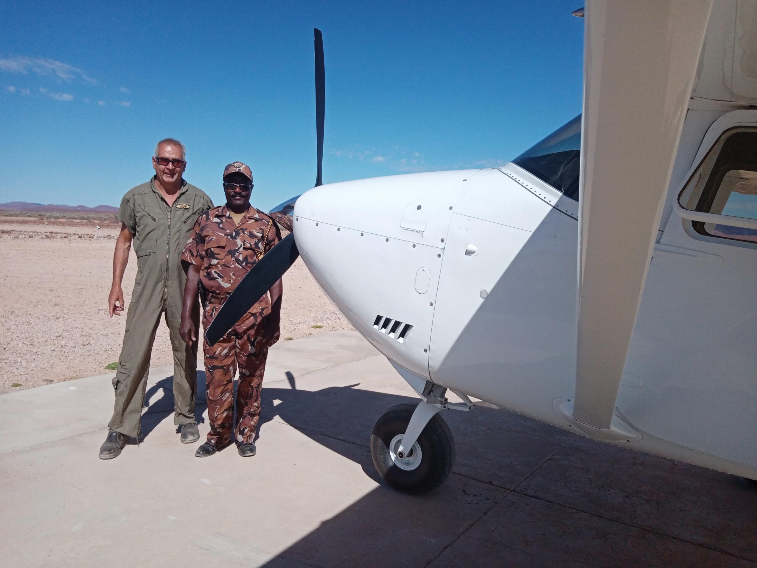
Text Conrad Brain (BVSc, PhD) | Photographs Conrad Brain (BVSc, PhD)
From the Autumn 2022 issue
Palmwag and Desert Rhino Camp in Damaraland are 10 nautical miles apart. Ask anyone at Palmwag where Desert Rhino Camp is and he will point westwards and say “net oor die bult” (just over the ridge). To drive there takes over an hour. To walk there would take the better part of a day. By aircraft it is a three-and-a-half-minute flight.
However, the ruggedness of the terrain stretches above ground level. Your three-and-a-half-minute flight will take you between the towering flat-top Etendeka mountains, over a series of successive basalt ridges, along an ancient drainage line, and into a chasm that was formed as the earth shook. The rivers of air that you will navigate can be kind and forgiving if the airstream is calm and untroubled; or it can be harsh, unforgiving and deadly if the air is moving like a wild river that becomes a beast of its own making, complete with streaming air-falls, hidden vortices and standing wave rapids. The terrain below conducts and directs the air overhead into a symphony of unfathomable discord.
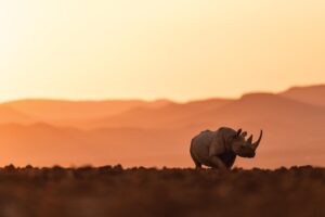
The early morning calm – as the rocks awaken to a glowing blanket of pink and red light – is the right time to kick the tyres and light the fires of your big continental engine and head for the skies. In the oblique light, long shadows are cast and the plants and animals of the area stand out like miniature castles within their own mountainous fortress. The black rhinos, still high on the ridges after a period of night foraging on euphorbia, walk along established pathways traversed so often that the ground underneath sends up puffs of dust with each heavy footstep as they start their descent. The mountain zebras seem to enjoy securing the highest vantage point available and watching the rising sun. Giraffe shadows 20 metres long give their position away as they forage on boscia trees of equally long shadow. This all happens amidst the morning chorus of the Rüppell’s Korhaan.
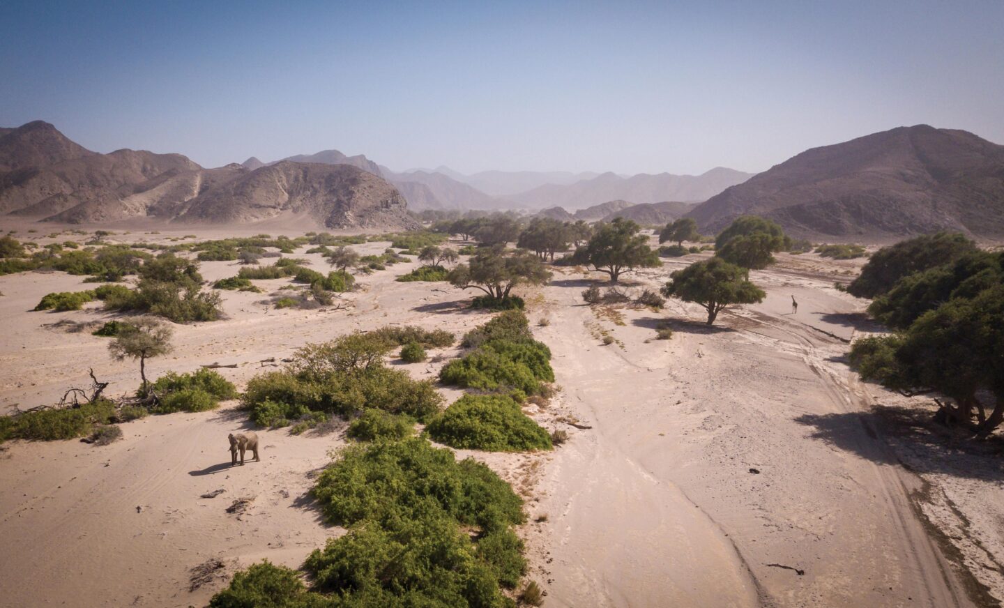
As the shadows shorten, you notice that all the drainage lines head downwards, incised in the ancient larval topography, and many converge into larger systems, until they terminate and merge with the several major westerly flowing ephemeral rivers of Damaraland that all point in one direction – westwards, towards the Atlantic Ocean.
Within these ephemeral rivers – linear oases – live the desert elephants. They are not confined year round to these dry rivers but are dependent on them as vital arteries of food and water. The Ugab, Huab, Uniab, Hoanib and Hoarusib are the lifelines onto which the desert elephants cling and depend on.
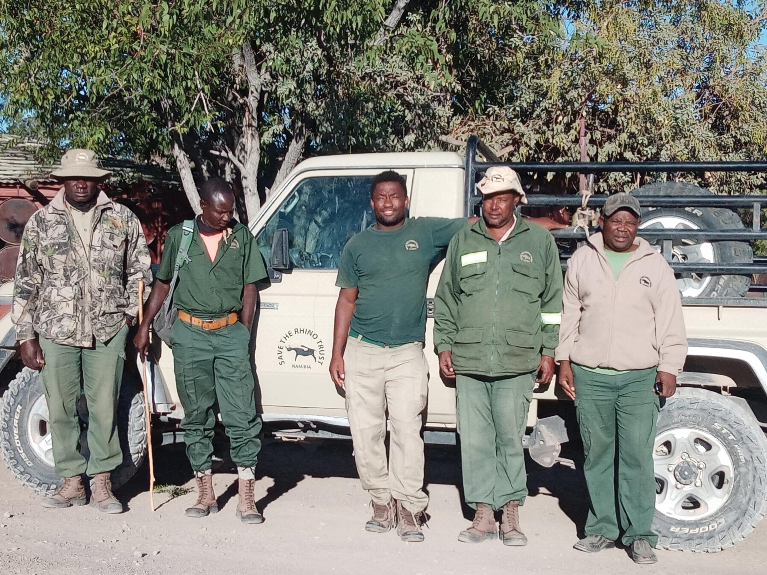
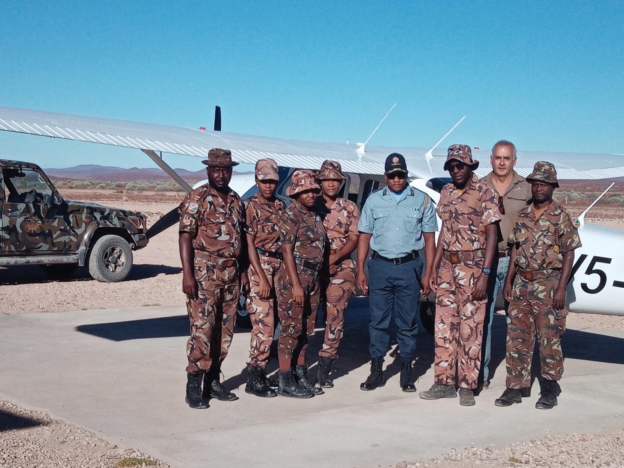
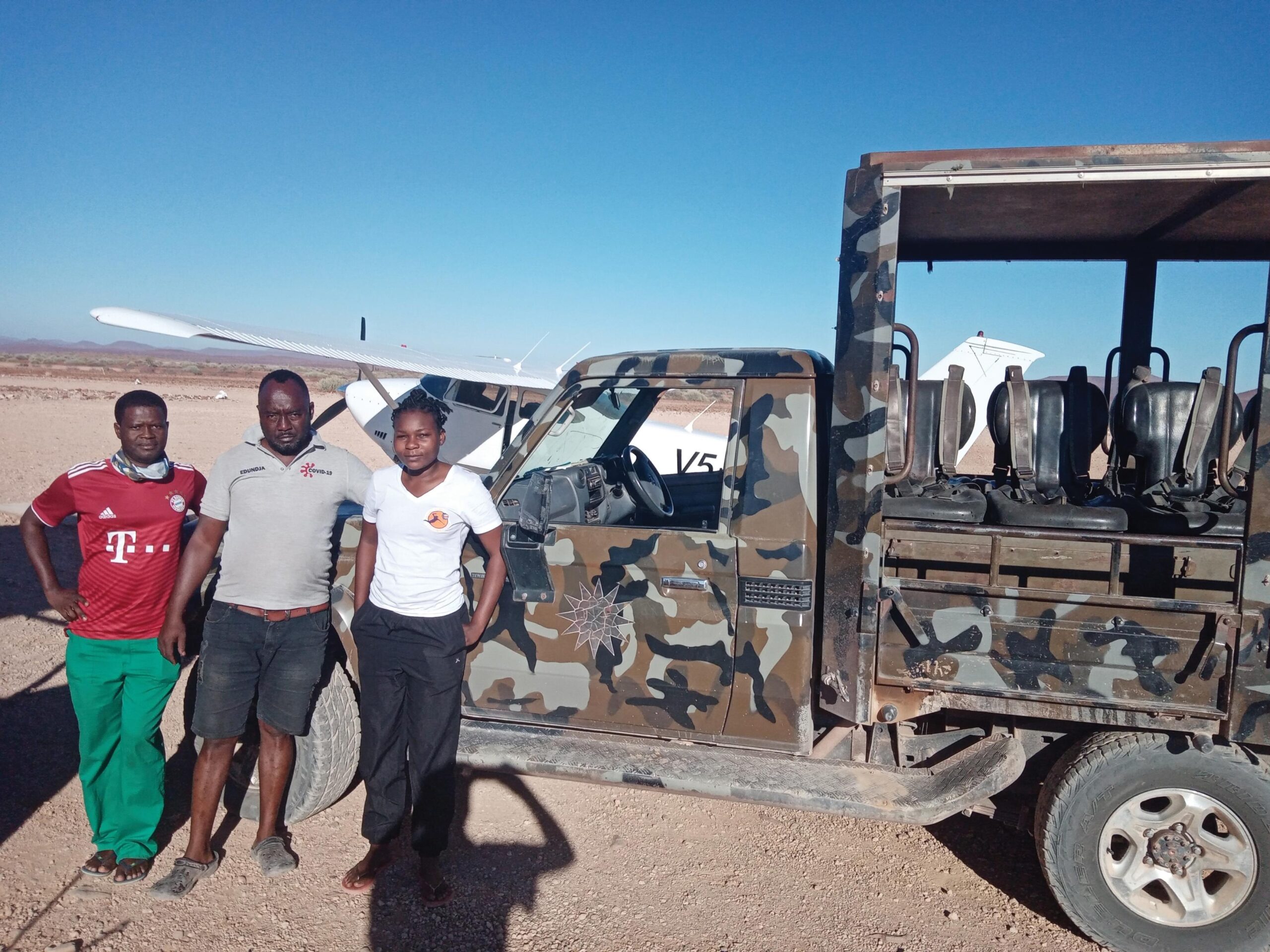
With this in mind, and with a focus on the elephants and rhino, a joint security and monitoring aerial operation was launched in December 2021. The aim was twofold: to support the ongoing anti-poaching efforts through aerial monitoring and observation, and to attempt to get a count of the desert elephant population between the Ugab and Hoarusib rivers. An operation like this needs many diverse partners, all giving rather than taking and all with a common goal: the conservation and protection of a piece of our planet that is unique and irreplaceable. Westair, Save the Rhino Trust, the Namibian Chamber of Environment, Rooikat Foundation, Namibian Police Force, Ministry of Environment, Forestry and Tourism, Gondwana and Wilderness Safaris joined hands to structure and support an operation with ambitious yet achievable goals.
Finding the elephants is one aspect of the operation and then counting them is another. Lady Luck smiled on us this time, as not only did we find the elephants, but they were in relatively open spaces where we could get as good a count as possible. The best sighting we had was rather comical. It was a gathering of elephants on the road at the picnic site on Dopsteekhoogte Pass near Wêreldsend. From a distance I assumed the gathering might be a group of tourists stopping for a dop on Dopsteekhoogte. As we got closer, we saw it was not tourists but elephants, casually gathered around the resting site, probably on their way to the Huab via the Springbok River.
The value of being airborne in a terrain where rock and surface features limit even short journeys cannot be overestimated. In a short but intense period of flying time across the Damaraland region, the community of the area saw us every day, we saw them, we noted any suspicious activities, recorded wildlife sightings, counted elephants, found mortalities, navigated extreme conditions and yet somehow always returned to a safe port. We could also provide a daily morning traffic report of the roads between Bergsig, Palmwag, Driefontein, Warmquelle, Sesfontein, Grootberg, Brandberg and the Giribes plains.
Damaraland, in all its splendid glory, is a dangerous place. It is harsh, unforgiving and beautiful. For all its robust boldness, the wildlife of this domain is fragile, as it is living on the very edge of climatic extremes and survival. The danger for this wildlife cohort of desert survivors comes not from the evil that somehow seeks to destroy it, but from those who do nothing about it. TNN
Facebook
Twitter
LinkedIn
Pinterest

More to explore
Read the Autumn issue