
Namibia’s Wettest
Wonderland
Cradled by the Kwando and Linyanti rivers at the Zambezi Region’s southernmost point, lies Namibia’s largest conserved wetland area, the 28,500-ha-large Nkasa Rupara National Park. Complex tectonic, climatic and hydrological events have shaped and reshaped the wetlands over countless aeons. The most dramatic change took place millions of years ago when uplift along the Linyanti Fault diverted the Kwando River into a northeasterly direction.
Text Willie Olivier
From the Autumn 2022 issue
Since then, the fate of this extremely dynamic system has been at the mercy of the rainfall in the Kwando River’s catchment area in central Angola where it is known as the Cuando. No two seasons are the same. Blockages caused by sedimentation and dense reed beds or floating vegetation divert water into channels that have been waterless for decades, while channels that flowed only recently become dry unexpectedly. Hippos play a role in the constantly changing waterways by keeping channels open, while a termite mound built in a channel during a dry cycle can force the water to find another course. Peat beds act as sponges, releasing the water gradually during the dry season, but during dry cycles they become part of the floodplain grassland and are prone to peat fires.
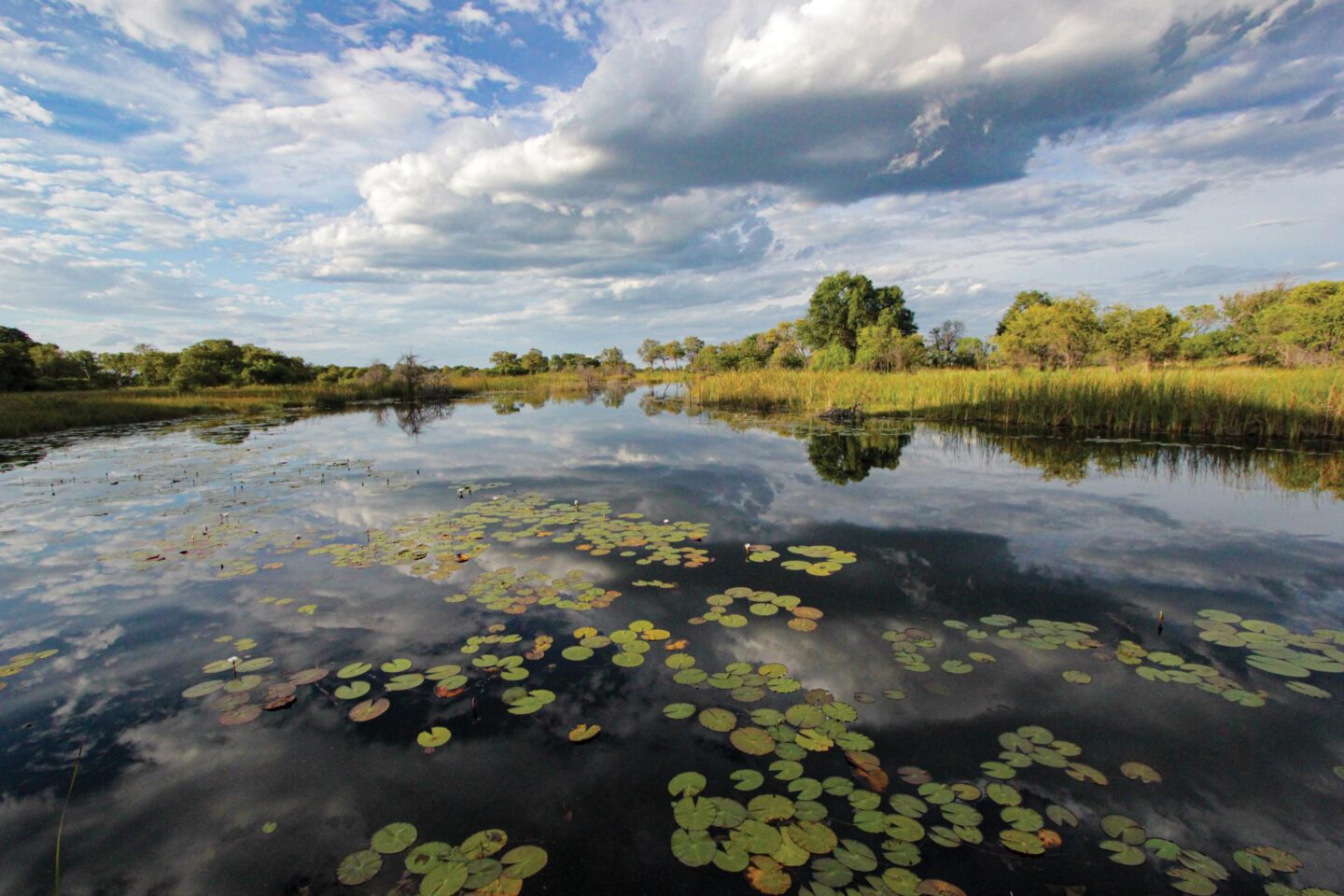
The Kwando River usually peaks at Kongola in May/June, but the water only reaches Nkasa Rupara several weeks later because of its meandering course and gentle gradient, while reeds, papyrus and floating vegetation also slows its flow. During very high levels, the water of the Kwando River flows along an intricate network of southeastward-flowing channels that dissect the grasslands and floodplains. Large areas are flooded when the channels overspill their banks.
During years of major flooding, such as the 2008/9 flood, up to 80% of the park is inundated, leaving only Nkasa and Rupara standing like islands amidst a vast expanse of water. Water flowing along the channels that dissect the floodplains transform the wetlands into a mosaic of lily-carpeted channels, vast reed beds, tranquil backwaters, pools and oxbow lakes. Large areas remained inundated until 2014 when the water began receding, but deep channels still prevented access to Nkasa Island many years later.
Wet cycles are periodically followed by dry cycles. Below- average flows of the Kwando River from 1991 to 2000 resulted in a dry cycle that lasted more than a decade. The floodplains were completely dry by 1994 and largely remained dry until the 2005 wet cycle started.
NKASA RUPARA NATIONAL PARK
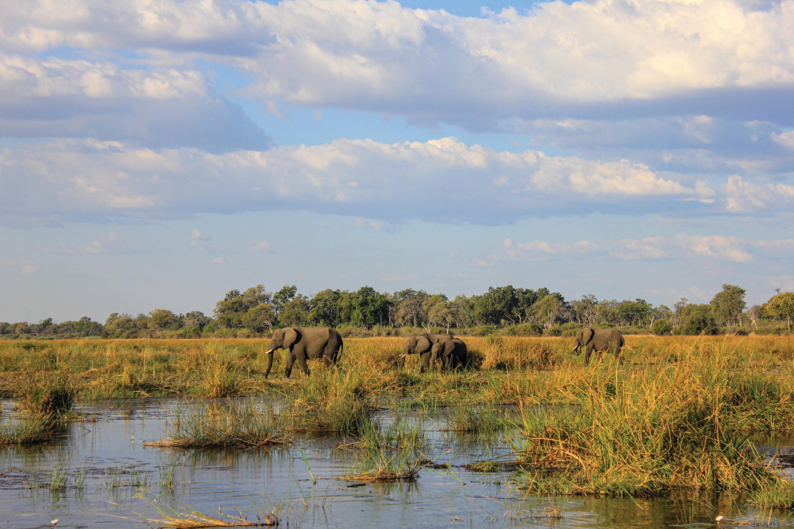
The park, originally named the Mamili National Park, was proclaimed in 1990, but renamed the Nkasa Rupara National Park after the two large, elevated areas (‘islands’) in 2012. It is a sanctuary to the largest buffalo population in Namibia, while large herds of elephant congregate on the islands of Nkasa and Rupara during the dry winter months. Red lechwe, waterbuck and reedbuck can be seen on the floodplains, while the elusive sitatunga occurs in dense papyrus stands. Plains zebra, blue wildebeest, impala, bushbuck, kudu, warthogs, vervet monkeys and baboons also roam this area.
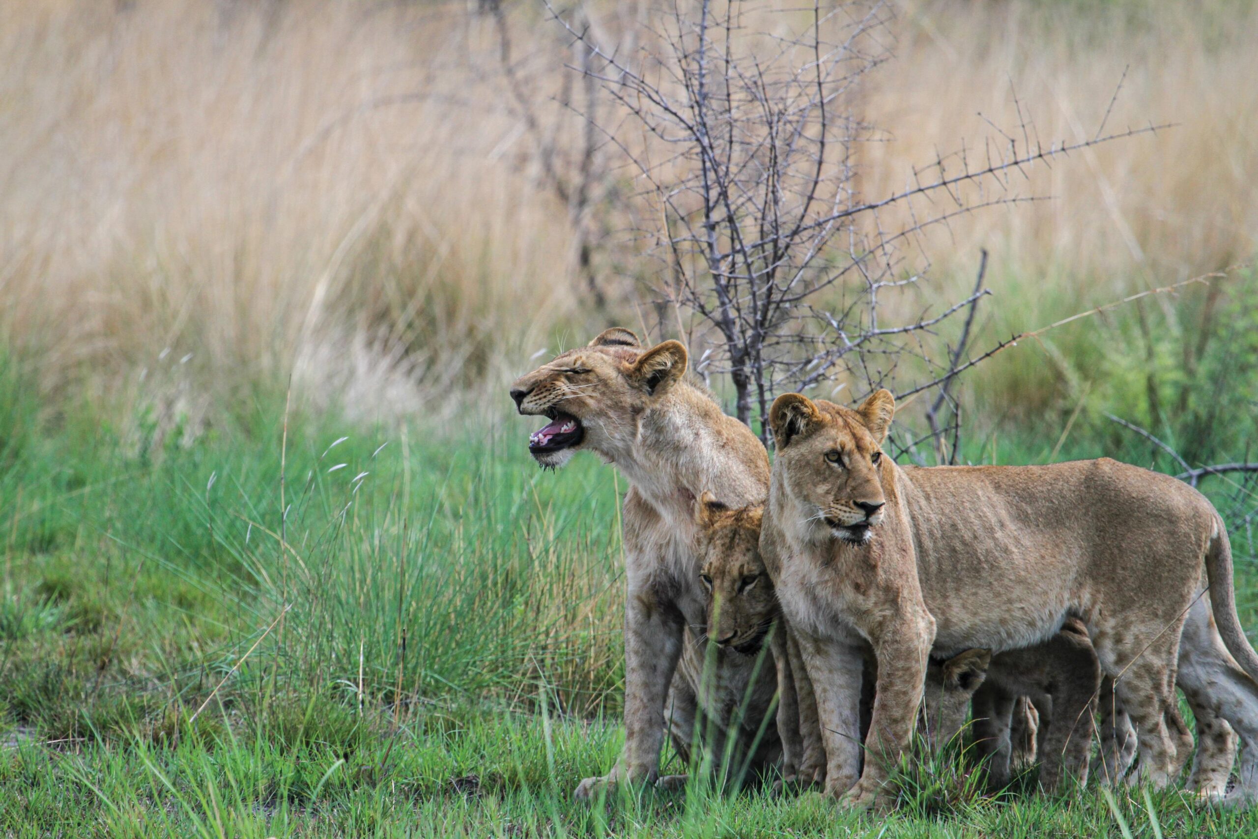
Hippo and crocodiles abound in the Kwando River, oxbow lakes, backwaters and pools. The large predators are represented by two resident lion prides, leopard and spotted hyena. Serval and civet cat, two rather elusive carnivores, have also been recorded in the park.
The diversity of aquatic habitats, grasslands and patches of woodland supports a rich and varied birdlife. With a checklist of over 400 species, the park is one of the top birding spots in Namibia, among them endangered species such as the Southern Ground Hornbill, Wattled Crane, Slaty Egret, Rufous- bellied Heron and Saddle-billed Stork. The Black and Coppery- tailed Coucal, Swamp Boubou, Long-tailed Starling, Chirping Cisticola and Rosy-throated Longclaw are among the other noteworthy species. TNN
COMPLEX LINKAGES
Where the Kwando River makes an almost 90-degree turn northeast, its name changes to the Linyanti and at this point the Selinda Spillway links the Kwando River to the Okavango Delta. Water from the delta flowed into the Kwando for the first time in nearly 30 years during the exceptionally high floods of 2008/9, while water from the Linyanti also flowed into the Savuti Channel for the first time in nearly three decades.
During major floods, water from the Linyanti reaches the ephemeral Lake Liambezi which is also fed by water which flows along the Bukalo Channel which is linked to the Zambezi River. When full, the water flows into what is known as the Chobe River.
EXPLORING NKASA RUPARA
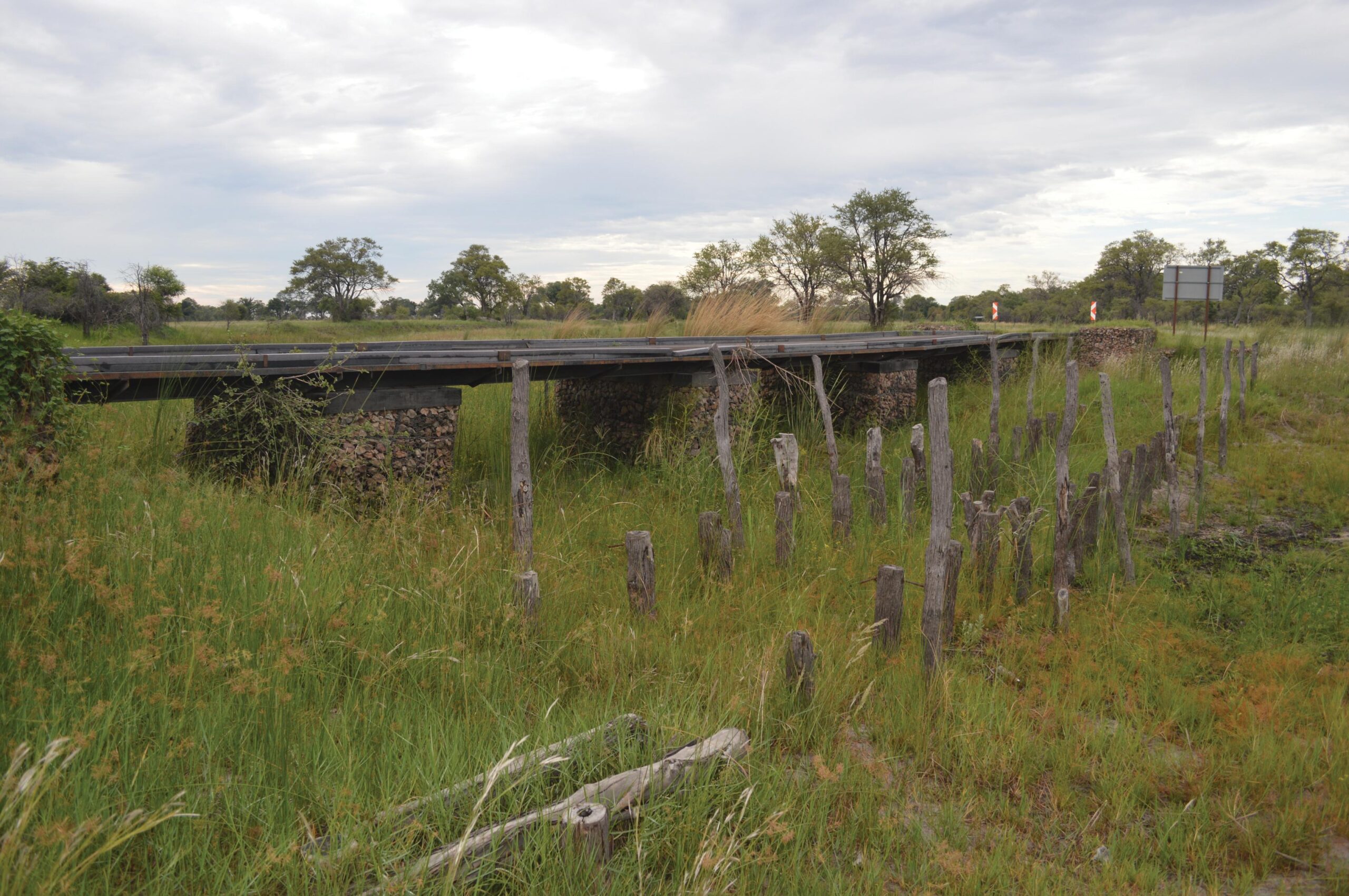
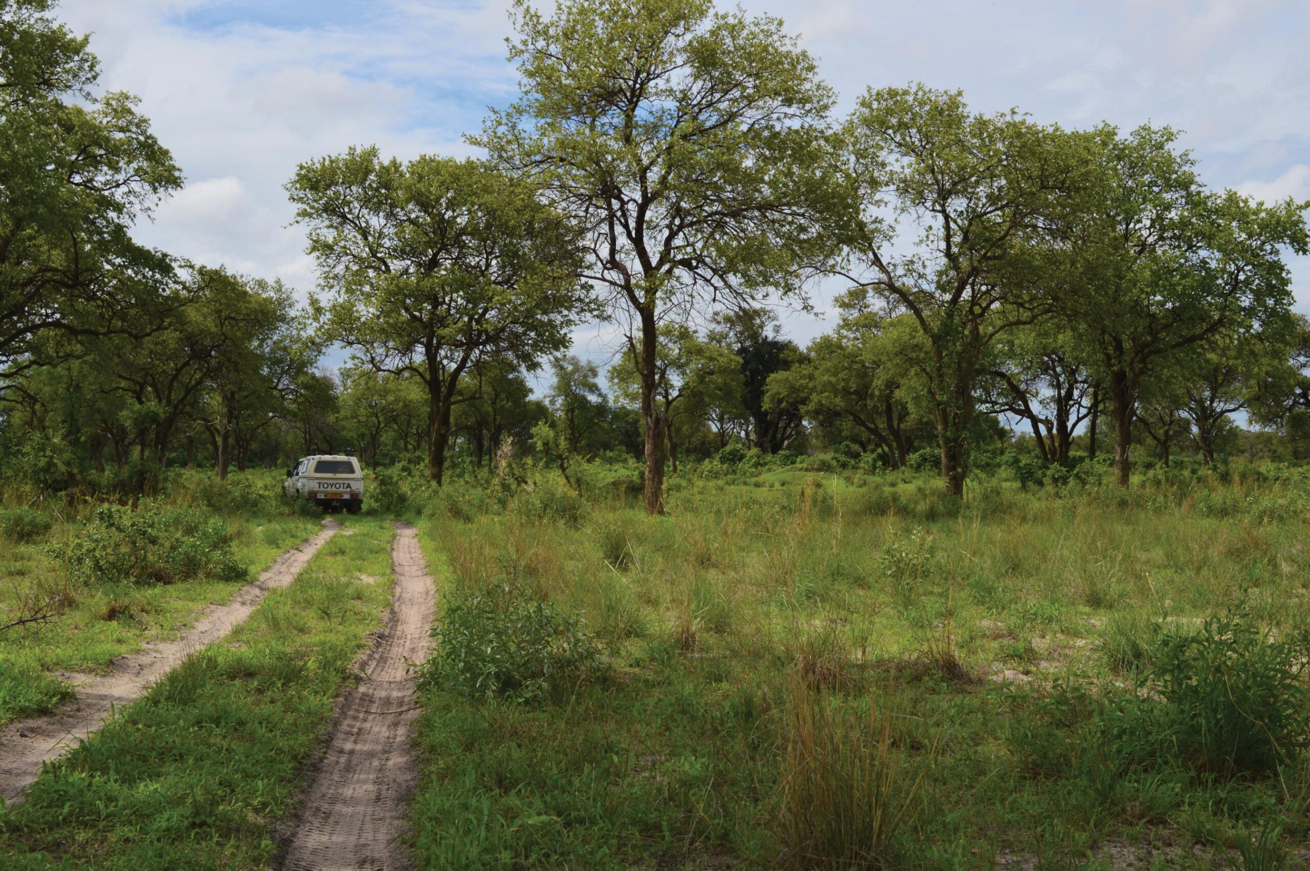
Nkasa Rupara is only accessible in a four-wheel-drive vehicle and large areas are inaccessible after high floods. Travelling parties should consist of a minimum of two vehicles and carry recovery equipment in case of an emergency.
Camping is not permitted in the park, but there are several campsites just a few kilometres from the park entrance:
- Rupara Restcamp, 3 km north of the park entrance, is managed on behalf of the Wuparo Conservancy. It has campsites with communal ablutions, campsites with own ablutions and self-catering chalets sleeping two people and a family chalet. Tel: 066 686 101; email: ✉️
- Nkasa Lupala Tented Camp, 1 km from the park entrance, is a joint venture between members of the Wuparo Conservancy and the owners, the Micheletti family. This eco-friendly lodge won the Responsible Tourism Award in 2016 and has been awarded five desert flowers (the highest ranking) by Eco Awards. Guests are accommodated in luxury tents, while the central area consists of the reception, dining room, lounge, bar and a viewing deck overlooking a channel. A variety of activities is offered. Tel: 066 68 6101; email: ✉️
- Jackalberry Tented Camp is situated in a concession area in the park, 13 km from the park entrance at Shishintze. Guests are accommodated in four luxury tents, while the main area, the double-storey Jackalberry Tower, accommodates the reception, dining area, lounge and bar with magnificent views over the grasslands. A variety of activities is offered. Tel: 061 25 0725; email: ✉️
Maps: The Kavango-Zambezi National Parks map which covers the tracks in and around Rupara Island is indispensable.
Facebook
Twitter
LinkedIn
Pinterest
More to explore


Read the Autumn issue