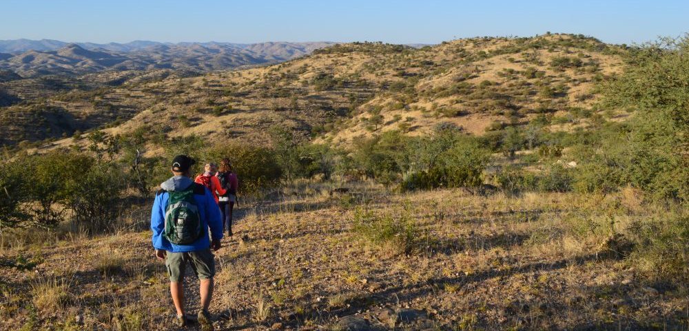
Soon after setting off on the 9 km Rooibos Trail in the Game Reserve on a chilly morning, we stopped in our tracks as we spotted a herd of blue wildebeest heading to the waterhole beyond the office.
After watching their antics for a while we continued along a dry river course for about one kilometre where a signpost directed us to turn left. From here we ascended steadily and paused to catch a fleeting glimpse of a gemsbok (Oryx gazella) that took flight but stopped to look at us once it felt safe.
The trail took us through thornveld savannah vegetation, a mosaic of thorn trees and other species, including the red bush willow or rooiboswilg (Combretum apiculatum) after which the trail has been named. In Namibia it is commonly referred to as the kudu bush or koedoebos – a reference to the popularity of its leaves with kudu and other wildlife. Some of the trees along the trail bear name tags, making it easy for those unfamiliar with Namibia’s plants to identify them.
Our first destination, a trigonometric beacon 1 783 m above sea level, was reached sooner than we had anticipated. The beacon marks the highest point of the park and lent itself as the ideal place to have a cup of coffee while we enjoyed the spectacular 360 degree view. To the east we looked down on the Windhoek valley and the sprawling city while the rolling hills of the Khomas Hochland unfolded around us. We counted ourselves lucky as there was a small group of Hartmann’s mountain zebra and two blue wildebeest in the valley below us and a few minutes later, three gemsbok appeared. The game reserve’s kudu, red hartebeest, springbok and giraffe unfortunately evaded us.
After a short break we shouldered our day packs to tackle the next leg of the trail which meanders downhill for quite some way before climbing up to a ridge. A long steady descent along another ridge followed with some sections that needed to be approached with caution – largely because of the loose gravel.
TICK OFF 200 BIRDS
With a checklist of over 200 species, Daan Viljoen offers exciting birding opportunities, including several near-endemic species. Rüppell’s Parrot, Monteiro’s Hornbill, Carp’s Tit, Rockrunner, White-tailed Shrike and Violet Wood-hoopoe are among the noteworthy species that have been recorded in the park.
About 45 minutes after leaving the beacon, we arrived at a river bed which is usually dry. We crossed the river course several times and decided to take another short break to top up our energy levels with some nuts and raisins, biltong (good protein) and some energy bars. After following the river bed for about 30 minutes we came to a jeep track, but after just a few metres a signpost directed us to turn left. A steep uphill slog of 20 minutes awaited us until we emerged at the old restaurant complex.
An easy 15 minute walk along a tar road took us past the Augeigas Dam back to the start, just over three hours after setting off. The dam with its 31.5 m high wall was built in 1933 following the devastating drought of 1931/2. A rich variety of waterbirds, as well as game, are attracted to the dam when it contains water. But unfortunately it had received little inflow during the past rainy season and we saw only a solitary duck on what little water was left.
WAG-‘N-BIETJIE TRAIL
The Wag-‘n-Bietjie Trail is a shorter and easier option, suitable for families with children. Starting near the office, the trail follows a dry river course for 1.5 km to the Stengel Dam which is usually dry after poor summer rains, but after a good rainy season the dam attracts a variety of birds. The trail owes its name to the common Afrikaans name of the buffalo thorn: ‘Wag-‘n-bietjie’, which means ‘wait a bit.’ As the name suggests, you can easily get caught up in the sharp, hooked thorns on its branches.
DID YOU KNOW?
- The park is only 25 km outside the capital and open throughout the year. Day visitors have access between 06h00 and 18h00.
- An entrance fee is payable at the office.
- Visitors over 16 years: Foreign N$ 40; SADC citizens N$ 30; Namibians N$ 10; Sedan vehicles N$ 10. The office opens at 06h30 and hikers are required to sign in before setting off and to sign out after completing the trail.
- A fee which varies seasonally is payable by day visitors using the Boma Restaurant and other facilities of Sun Karros. Bona fide hikers who enter the park before 10h00 are not required to pay the Boma Day Visitor fee. Sun Karros, however, reserves the right of admission.
- A map of the trail is available at the Ministry of Environment and Tourism office in the park.
This article was first published in the Autumn 2020 issue of Travel News Namibia.


