The ultimate slow travel is
on a bicycle
Text Rièth van Schalkwyk | Photographs Louis Wessels
From the Summer 2021/22 issue
Don’t ask a cyclist who has done most epic cycle events in South Africa and Namibia why he needs to pedal 1400 km solo all along Namibia’s northern border from east to west – from Katima Mulilo on the banks of the Zambezi to Epupa Falls on the Kunene. From the water-rich riverine north-east to the arid semi- desert of Kaokoland. From the region with the highest rural population density to one with the lowest.
It seems like the silliest question to ask because the answer will always be “why not?”
As the story unfolds, though, it becomes clear that there is a lot more behind the “why not” than just pushing the pedals.
On two wheels, with only the bare essentials fixed to a light frame, slow travel is the reality. To be in tune with only what goes on around you and your bike. With no back-up, itinerary or time constraint, life along the road is like a slow shifting movie set or a reality TV show in which you also play your part as a source of entertainment to onlookers.
It is a physical challenge. September in northern Namibia is hot and dry. You better be in the saddle before sunrise when the sky and then the sun turn spectacularly red from the haze and dust in the air.
Early morning is the busy time along the road. People are coming and going. Locals on bicycles do not ride for fun. They carry wood, take children to school or transport their wares to and from.
On a bicycle the rider becomes part of the scenery and almost part of the community. You sweat in the same heat as the woman and children who carry heavy piles of water to irrigate their small fields, or boys herding cattle, riding on a donkey cart, catch and sell fish or push their wire toy lorries along to a roadside market.
To be a keen photographer on a solo cycle tour poses yet another kind of challenge.
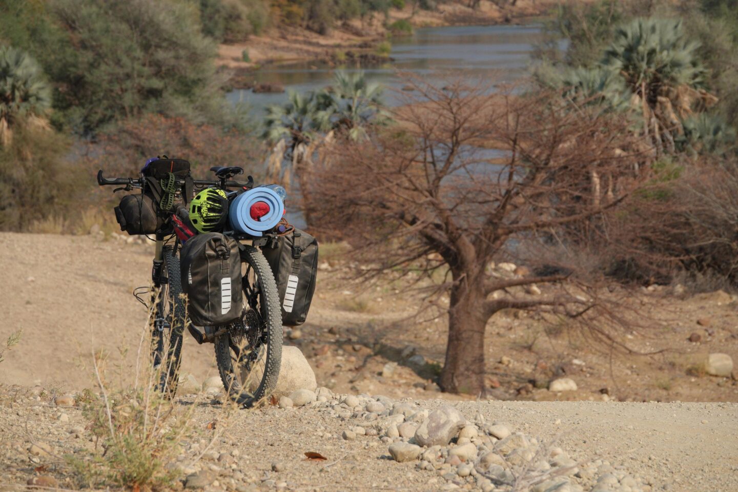
How to minimize weight and space? No passenger seat with camera bag open and ready. No beanbag in an open window. Best you can do is a fixed-lens Sony strapped to the handlebar. Forget about a tripod.
You see the photo. The light is perfect. Smiling faces glow. Water splashes against the sun. Glorious. But then you have to get off the bike and secure it with all that is strapped to it. Get rid of the gloves. Get the camera out, ready and focused before the moment is gone. Then, just when you are ready, the photo opportunity is lost as the subject disappears or moves on.
Best time to capture the mood and the movement of life by the roadside is during a lunch break in the shade of a camelthorn tree with its sweet smelling yellow pom-pom blossoms. You know it is Sunday when a parade of brightly dressed chirpy villagers walk past carrying their bibles. Big smiles on happy faces greet you when you share the shade with women binding heaps of thatching grass while the kids play in sandy soil, blackened by veld fires over millennia. To sit against a mopane tree having a midday snack when the rustling of dry leaves turns out to be a passing herd of elephant is quite scary. Even if the temptation to move closer for a photograph is very real. One learns quickly how close is too close for getting away from danger on a bicycle.
That is while cycling from Katima Mulilo, through Mudumu National Park and the communal land and communal conservancies of five Caprivian tribes. They make a living tending crops, catching fish, farming with cattle and from the many opportunities provided by a thriving tourism sector (that was before Covid, but it is slowly returning). Wildlife and people live together in this region. Elephant and zebra migrate through to Botswana and back. Lion, leopard and cheetah are sometimes spotted unexpectedly. Buffalo herds move from woodlands to the flood plains to feed and to drink from the river.
At Kongola you cross the Kwando River into Bwabwata National Park and 200 km later you cross the bridge over the Okavango River at Divundu and Bagani, entering into the Kavango people’s traditional land along the Okavango. On towards Rundu, travelling on the old gravel road. At Nkurunkuru you turn westward away from the river leaving behind the hustle and bustle and abundant wildlife of the north-east.
On a rather straight, relatively new, tarred road through woodland you enter the land of the Aavambo people and 160 km further on reach a small town of Okongo.
From there it is flat and straight – parallel to the man-made border between Namibia and Angola through Eenhana, Okolongo and Outapi, which intersects with the main road from Oshakati to Ruacana. Through Efunja flood plains, past villages and roadside shops, clusters of tall makalani palm trees interspersed with the odd giant baobab tree closer to Outapi. No roadside camping on this stretch, but there is comfortable accommodation in guesthouses in the towns.
From Outapi it is straight on to Ruacana which signals the end of flat, sandy landscapes. This is also the place where the Kunene enters Namibia from Angola and where Namibia’s only hydroelectric power station was built in 1981. A spectacular view from the top of the escarpment over dense mopane woodland and the Kunene River valley down below is not the only treat. It also provides the first glorious downhill sections of the entire route, followed by undulating landscape and a white limestone gravel road for the last 150 km, past Swartbooidrift to Epupa. Your average speed drops by almost a third in what is quite a physical challenge.
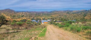
This last stretch is Kaokoland where the nomadic Himba people move about to where the grazing is best, but during the past few years of severe drought they stayed close to the river. It is a completely different world from that where the route started. It is wild in a singular way, sparsely populated with much less abundant wildlife, but interesting vegetation and geography. For the first time on this tour there are mountain ranges, the Zebra Mountains being the most interesting geological feature. They display a feast of different Commiphora trees with their interesting forms, especially without leaves in the dry season, and on the riverbank makalani palm trees grow in dense clusters as well as old leadwood and ana trees. Along the way you may encounter Himba women in their traditional dress, or a young man walking with a stick and bundle behind his goats.
Over the last steep climb and down to the little village, the palm trees and picturesque Epupa Falls.
17 days later. TNN

