Why
Ruacana Waterfall
deserves a spot on your Namibia itinerary
Ruacana Waterfall is not a destination that tops the “why you should visit Namibia” click-bait lists. In fact, it rarely even makes the list, if I think about it. Why is this natural wonder, situated on the stretch of the Kunene River downstream toward Swartbooisdrift, so often left off itineraries proposed by travel agents? Le Roux van Schalkwyk explores…
From the Spring 2024 issue
The first indication that you are approaching the town of Ruacana is a welcome sign with letters that have broken off long ago, guarded by a statue of a headless Himba woman. Not much of a welcome to the town that shares its name with Namibia’s largest waterfall. At 120 metres high and 700 metres wide when the Kunene River is in flood, Ruacana is one of Africa’s largest falls measured by volume and width. Why, then, is Ruacana not one of the premier tourism spots in the country?
The simple answer is that the Ruacana Hydroelectric Power Station, set above the falls, uses most of the water for hydroelectric production during the greater part of the year. During the dry season, the flow of water to the hydroelectric station is regulated through the Calueque Dam about 40 km upstream in Angola. The diversion weir situated above the falls feeds the 8-metre-wide underground pressure tunnel that stretches 1,500 metres from the Angolan side and leads to the surge head bay of the power station. Unfortunately, this means the Ruacana in its full glory can only be seen when the Kunene is in flood, fed by the annual monsoons in central Angola. This occurs roughly from December to May.
It is interesting to note that when the Kunene is in flood, the Ruacana Power Station’s three turbines push out 347 megawatts. At Namibia’s current demand of 750 megawatts, almost half is generated by the hydroelectric plant. Unfortunately, this maximum output only lasts for a couple of months, depending on the rainfall in the Kunene’s catchment area.
WHAT DOES THIS MEAN FOR TOURISM?
The full flow of the waterfall is very season-based and rain- dependent. This does not make it easy to book a trip and have the certainty of experiencing Ruacana in its full splendour. But it does not mean potential tourists should be put off by this fact. Because this area is less developed for tourism than other parts of the country, it means that it is the ideal place to explore for the more adventurous. We visited the area in the dry season to see if it is still worth a visit.
To start with, Ruacana is very accessible. Two tarmac roads give access from the south and east – the C35 is perfect for anyone travelling from Etosha National Park and the C46 for those travelling through the culturally rich land of the Aawambo. Running west along the river is the D3700 gravel road. This road leads to Swartbooisdrift and will eventually reach Ruacana’s popular smaller cousin, the Epupa Falls. From Swartbooisdrift you can also travel south to Opuwo from where travellers can venture deeper into the Kaokoveld.
WHERE TO STAY AND WHAT TO DO
The town of Ruacana is 25 km to the east of the falls and is an interesting visit, as it was built during the construction of the hydropower station in the early 1970s to house its employees. It was also the location of the military base during the border war.
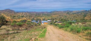
The town has a service station and shop, but do not expect much more. The people who live here are very friendly and a mix of the local OvaZemba and OvaHimba people as well as NamPower employees. Due to its small size, walking is the ideal way to explore the town with its large mopane and purple- pod terminalia trees. It is also interesting to note the relics from a previous era, like the half-moon-shaped corrugated iron segments, still seen in some backyards, which used to be part of bomb shelters.
Ruacana Guest House is situated on the eastern end of the town. With its green gardens and comfortable rooms, it serves as a relaxing place to kick up your feet after a long day’s drive or exploring the surrounding area. Owner Anne-Mare van Schalkwyk is not only a great host, but having lived here for a long time, she is a great source of information if you have questions about the town and its people.
Leaving town and driving west on the D3700 towards the falls gives you a glimpse of the colourful local populace as they go about their daily routines. Cattle and goats roam about, plenty of amusing shebeen names are on display and an open-air market awaits next to the main road.
Be on the lookout for a spot where you can pull off the road around 12 km from town. From here, a short walk will take you to a lookout point that offers an elevated view of the distant weir and waterfall to its left.
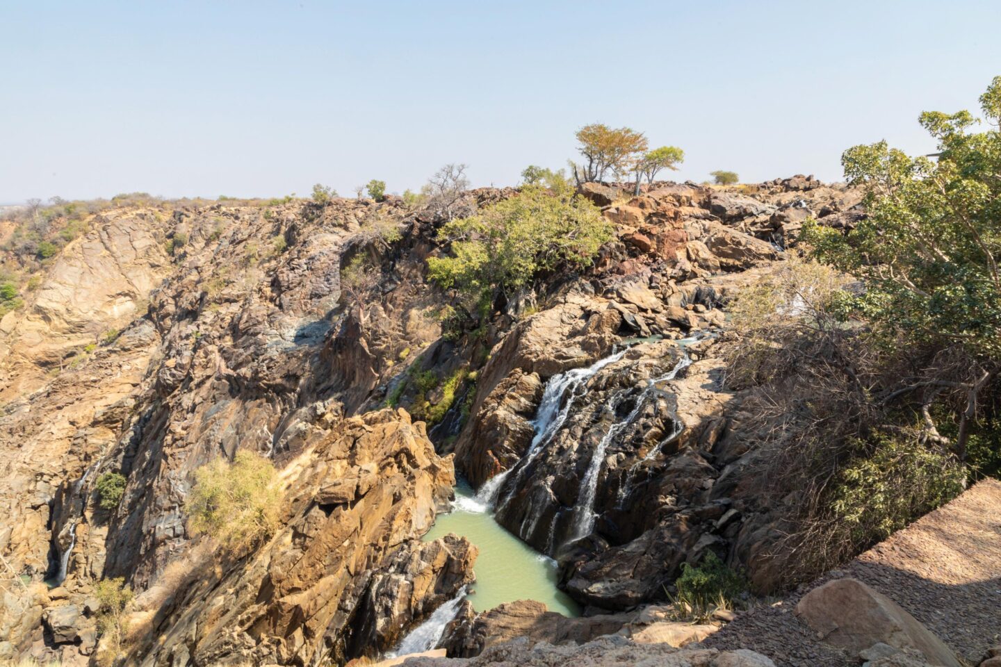
The viewpoint for Ruacana Waterfall is situated close to the border crossing. Even during the dry season, it is a must-visit site, with only a couple of streams cascading down the rock faces. It remains picturesque, nonetheless.
Stairs to the west of this lookout point take you down for views from ground level. Here the remains of the first small power station can be visited. It was set up to supply power for the construction of the main hydroelectric plant and decommissioned on completion of the project. Be careful, as some of these stairs have been flooded and require careful climbing to descend.
Heading downstream towards Swartbooisdrift, there are a couple of accommodation options:
HIPPO POOLS
This community campsite is set on a white sandbank under massive mopane and leadwood trees. It is conveniently situated close to the falls, but be aware that this area is prone to flooding in the rainy season and might not be accessible.
TJONKUVI OTJIRUWO
On a raised bank of the Kunene, this campsite has a great view of the river below the falls. It offers neat, lawned campsites as well as a communal area with a bar and pool.
OMUNJANDI RESTCAMP
Also located on the waters of the Kunene, the rest camp gets its name from the huge omunjandi or jackalberry trees that create a densely shaded camping area – much needed, especially during the summer months. Apart from the campsites, Omunjandi also offers five luxury tents as well as a self-catering chalet that sleeps four. The activities on offer include hiking, Himba village tours and sundowners.
RAYCANA
The new kid on the block, Raycana, recently opened its doors and caters to all types of campers with its two campsites. Situated on a koppie to the south of the road, this can be seen as the premier campsite. The views of the river and surrounding Kaokoveld steal the show. Apart from the shaded campsites, there is a large communal area with a tuck shop as well as a sundowner spot that arguably has the best view in the area. The other campsite is north of the road on the tree-lined riverbank. This one is for the more rugged or self- sufficient campers, as the facilities are more basic. They offer guided day hikes, a seven-day hike from Ruacana to Epupa and Himba village tours.
The Ruacana area is rich in culture and natural beauty. Even if the waterfall is not in flood, there is plenty to explore around the town and along the river. When planning your next trip, be sure to add Ruacana to the list. TN
The very first site to be referred to as Ruacana was a trading post in the area on the banks of the Kunene River, established in the early 1800s by Portuguese traders. They named it after the Himba chief at the time, called Ruhacana. They could not pronounce his name correctly and this is where the current spelling originates from. The local name for the area remains unknown.
More to explore

Discover Airlines launches a new direct flight between Windhoek and Munich
